Capacity Building for the MNRE and LTA, Samoa
Additional Specialist Services / Cadastral / Chartered Land Survey / DBX, HTML, XML, CSV ASCII Files / DXF, DWG, DGN / Education / Equipment / Geographic Information Systems (GIS) / GNSS / Land Information System (LIS) / Local Skills Transfer and Capacity Building / Pacific / Samoa / Software / Survey Standards / Workshops and TrainingClient: SMEC Pacific funded by the Asian Development Bank
Year: 2019
Country: Samoa
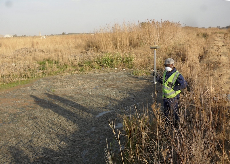
Together with SMEC, their local representatives MMSM Ltd, and the Asian Development Bank, the Ministry of Natural Resources and Environment with the LTA were given three weeks intensive training on basic work flow changes and in-depth understanding of all land information/registration systems currently in practice in Samoa. Using the Royal Institution of Chartered Surveyors material on GNSS as well as on boundaries, ethics and values; Leica training manuals on GNSS understanding; Martin L de Beer’s land legal and cadastral experience, a full training course was tailor made around the existing systems of Samoa land registration. This was to aid in the ongoing examination of new data in the form of UTM grid data captured with GNSS equipment (an upgrade from total station surveys on Lemuta); capacity building of the existing staff with the advent of new equipment bought for the department of MNRE and for a more interdepartmental (including LTA) open source approach to the work flows currently being followed.
The training and seminars included: three workshops, 9 days of class training, 5 days of field training and two full feed back sessions. A certificate of attendance was issued to those who attended the training.